
Regional Stormwater Protection
 The North St. Louis SWCD joined the Twin Ports Regional Stormwater Protection Team in 2020, supporting clean water across Minnesota’s arrowhead region.
Visit our regional sites to learn more about stormwater:
Learn more about what you can do to keep stormwater clean – because there’s no poop fairy to do it for you
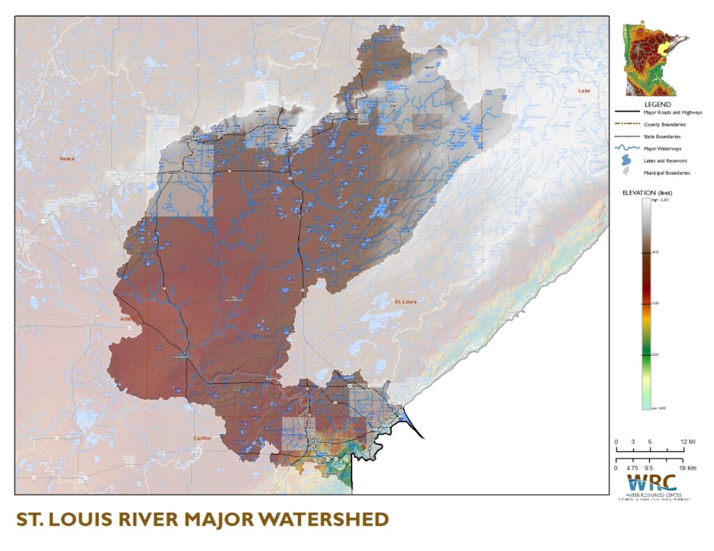
Learn more about the Saint Louis River watershed and stormwater in our communities
Stormwater

source: https://www.twincities.com/2014/10/10/friends-of-the-mississippi-project-puts-spray-paint-to-good-use/
Stormwater is the water that flows into lakes and streams after a rain or snow melt event. If you’re in a city, that means it goes through the storm sewer system. The storm sewers go directly to lakes and streams, not to a water treatment plant.
In landscapes with plant cover, water moves slowly and can be absorbed into the ground. It filters down to become groundwater or is used by plants.
Where people have built concrete and asphalt surfaces, the water flows more quickly and can’t be absorbed. This causes flooding, so people invented storm sewers. Storm sewers allow water to quickly flow to a pond, lake, or stream. Along the way, it picks up sand, salt, trash, yard waste, pet waste, and other debris. Nearly all storm sewer systems can’t remove these pollutants because filters would back up the system and cause flooding. Anything on the street will be in our streams when it rains.
Source: https://mrbdc.mnsu.edu/mnnutrients/watersheds/st-louis-river-watershed
Watersheds
All water flows downhill – until it reaches the lowest point in an area. That might be a lake, a sea, or an ocean. The area where water flows into a particular waterbody is called a watershed. Rainwater, snowmelt, and other water sources within a watershed will all eventually flow to the same place. In northern St. Louis County, we have three major watersheds:
- The St. Louis River flows southeast to Lake Superior, and eventually through the Great Lakes to the Atlantic Ocean
- Several tributaries flow south to the Mississippi River, and eventually to the Gulf of Mexico
- The Little Fork, Vermillion, and Rainy River all flow north, and eventually to Hudson’s Bay
Watersheds connect us all to the communities downstream and upstream. Our fishing lakes and drinking water sources get pollutants from upstream, and our pollutants go to communities downstream.

What can I do?
- Bag leaves and yard waste – just because it’s natural doesn’t mean it belongs in the water
- Become a smart salter – learn how to use deicers as efficiently as possible
- Pick up after your pets
- Plant native plants and maintain plant cover in your yard
- Wash your car at a car wash or on the grass (not on pavement)
- Keep your trash and recycling bins secured